Parking search and parking payment are two different processes and usually not connected. CurbIQ has integrated with HotSpot as a single tool to inform drivers where parking is allowed and available, and to easily pay for their selected parking session.
Regardless of whether a city has too little or too much data, there is always an option to produce a digital curb inventory to improve curbside management and urban development.
A digital-first approach to parking with CurbIQ and HotSpot minimizes risk with benefits of an environmentally sustainable, adaptable, and economical parking program.
Campuses are a great candidate for utilizing CurbIQ. From campus planners and visitors, to academic research, CurbIQ can help your campus become more innovative.
In 2021, the Southern California Association of Governments (SCAG) embarked on a region-wide curb space management study. The more specific and short-term goals include determining a blueprint to implement the best practices and on-street pilot projects.
Flexible curb management refers to ways that cities can optimize curb space that is in high demand in desirable areas. The flexibility allows cities to allocate the most suitable curb use to a specific location at a specific time.
Unmanaged on-street parking can undermine off-street parking solutions. A curb management solution can address these problems by creating, managing, and sharing parking regulations in a visual and easy-to-navigate way.
A future proof curb is designed and managed with the built-in capacity to quickly adapt to change. This can be supported by digitizing the curbside inventory.
The City of Toronto's ActiveTO Midtown Complete Street Pilot used CurbIQ to understand the existing curbside regulations along midtown corridors. This was a key first milestone for the project.
At CurbIQ, we are focused on using data standards that are most beneficial to our end users. We track what is being asked for, what new standards are emerging, and involve ourselves in the formulation of these standards where possible.
Availability of as-built curbside GIS data is often scarce. Fortunately, there are open source GIS data and tools available. The CurbIQ team uses two main open source initiatives to create curbside inventories.
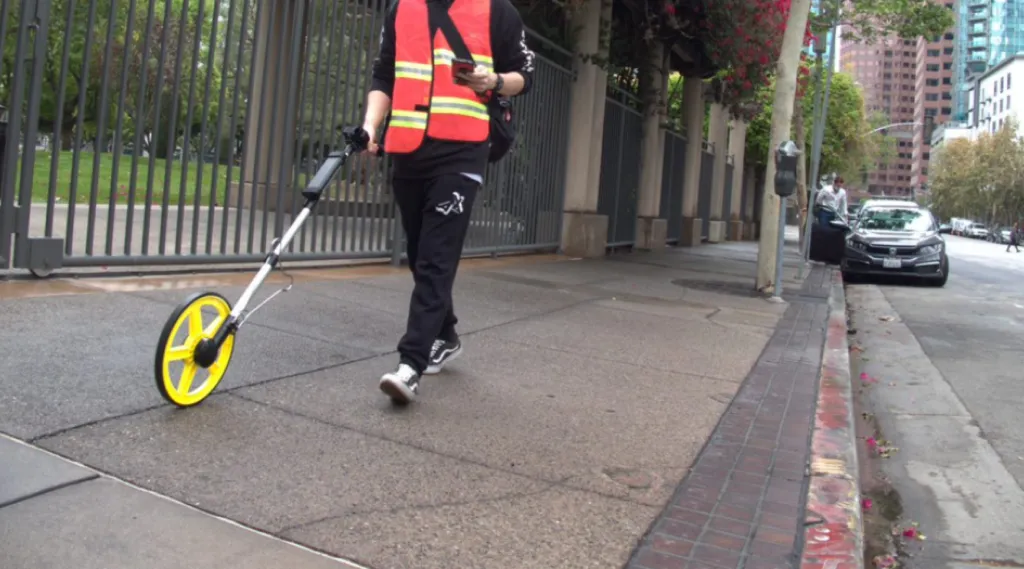
In 2016, the Los Angeles Department of Transportation (LADOT) launched Code the Curb, an initiative to create a digital inventory of the county’s curb regulations. This would require surveying the curb regulations on the ground.
The power of curbside data is enormous. By analyzing this data cities can understand the potential of the curbside to generate revenue, allocate space more efficiently, and communicate better with the public.
The size of Los Angeles County is truly mind-boggling. At just over 4,000 square miles, it is larger than Rhode Island and Delaware combined and home to more than ten million people.
Google and TriMet created the first-ever open-source transit dataset in 2005. Since then, hundreds of transit agencies worldwide have released open-source GTFS feeds.
The restaurant industry has been devastated by the COVID-19 pandemic. Those remaining in business have had to adapt their model and find creative ways to operate.
We’ve previously shown how quick and easy it can be for a city to get started by digitizing their existing curbside regulations. But once you’ve done that, what’s next?
Curb Manager was designed to help municipal staff efficiently update, create, review, and publish curbside regulations on a user-friendly platform. Now it can also be used as a pandemic response tool.
Jacob Malleau
March 11, 2021
CurbIQ resources
From articles to case studies to webinars, take curb management to the next level
Blog
Discover the latest industry news, interviews, technologies and resources.
.webp)


.webp)


.webp)