CurbIQ believes in the power of standardization. We are members of the Open Mobility Foundation and use the Curb Data Specification (CDS) for all our digital inventories. We can also accommodate other standards such as CurbLR or APDS, to meet your needs.
Having worked on dozens of curbside and parking studies, the CurbIQ team recognized a trend of cities lacking information about their curbside and parking supply. This inspired us to create Curb Converter, a highly automated collection of end-to-end curb regulation digitization processes that enable quick collection of curbside regulations for municipalities. The processes are composed of three main modules.

Open Data Automation can take any existing curbside data, and automatically convert it into a standardized curb regulation inventory. The only requirements are that the open data has some type geo spatial reference, it can then be standardized from there.
Recommended for: cities with lots of existing data who want to quickly get a digital inventory that they can later refine.
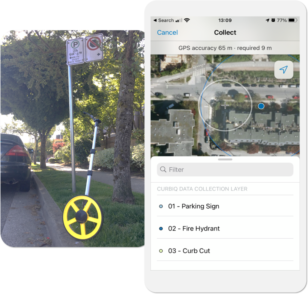
Curb-Level Surveying uses open-source measurement and capture tools (such as Esri’s Field Maps App) to collect curb regulation data with very high positional precision. Automated scripts then convert collected data and imagery into a curbside inventory.
Recommended for: cities who want an extremely thorough inventory dataset. Also suitable for small project or focus areas.

Augmented Mobile Mapping takes advantage of advanced image processing and machine learning techniques to automatically extract curb regulation data from images taken in a moving vehicle. Our processes then seamlessly convert regulation data into a digital curb inventory.
Recommended for: cities who want a scalable solution that is both cost-effective and efficient. Also for city-wide deployments of curb digitization.
We often recommend a blended solution of these solutions, so please reach out so we can help you on your curb digitization journey!